Dargon Map Room
 Our maps range in scale from the city of Dargon to the entire
continent that Dargon is on.They should be useful both for getting to know the world of Dargon, and also as a periodic reference.
Our maps range in scale from the city of Dargon to the entire
continent that Dargon is on.They should be useful both for getting to know the world of Dargon, and also as a periodic reference.
Note that most of our maps come in interactive and non-interactive versions. The non-interactive versions are simple images; the interactive versions use the same images, but also add annotations and Glossary links for each landmark. The interactive maps use DHTML and will not work for all browsers.
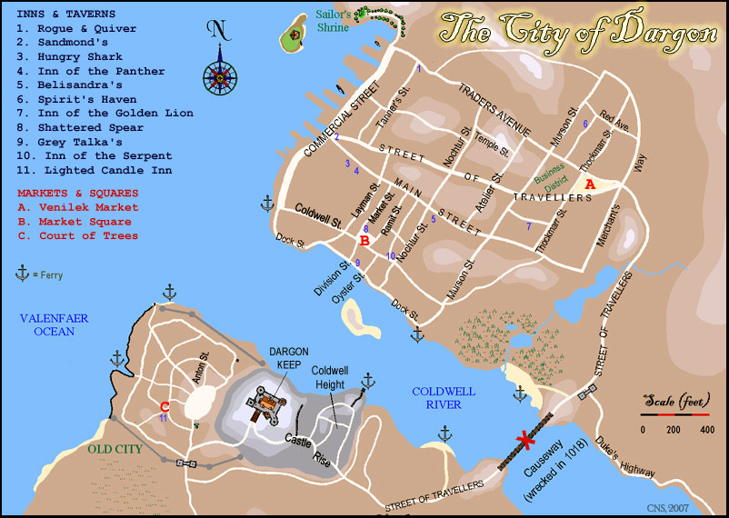
- Dargon Street Map Non-Interactive | Interactive updated 4/07
- An overview of the layout of the city of Dargon, with major streets and landmarks.
- Duchy of Dargon Non-Interactive | Interactive updated 4/07
- Shows the baronies and villages in the immediate environs of Dargon.
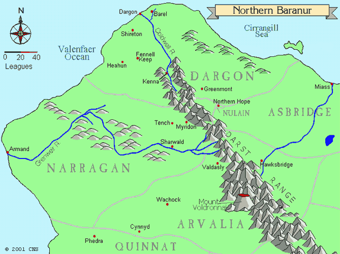
- Northern Baranur Non-Interactive | Interactive
- Includes the duchy of Dargon as well as several neighboring duchies in the northern half of the Kingdom of Baranur.
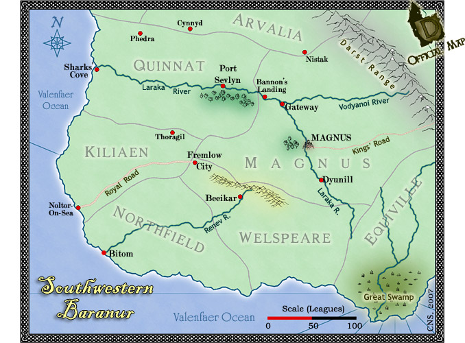
- Southwestern Baranur Non-Interactive | Interactive
- Depicts Magnus, the capital of the Kingdom of Baranur, as well as the watershed and cities of the great Laraka River.
- Kingdom of Baranur Non-Interactive | Interactive updated 4/07
- Shows the entire kingdom, including all its duchies and several bordering nations.
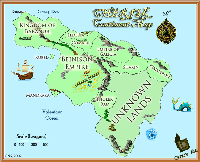
- Continent of Cherisk Non-Interactive | Interactive updated 4/07
- The entire continent of Cherisk, depicting Dargon, the Kingdom of Baranur, the Beinison Empire, and other very distant lands.